| Date of search - xxxx |
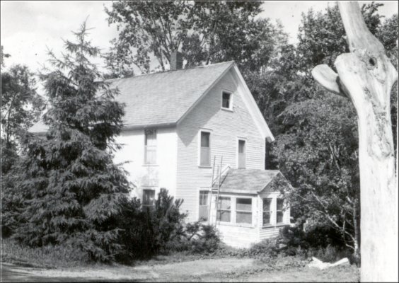
Common Name: Clayton & Ann Marie Carl |
Vermont Division for Historic Preservation Ref -
604_044_XXX
(This House Not Done)
COMMON NAME: Clayton Carl House
(Not done by the Vermont
Division for Historic Preservation)
ADDITIONAL ARCHITECTURAL OR STRUCTURAL DESCRIPTION:
| DATE | GRANTOR TO GRANTEE | BOOK | PAGE |
|---|---|---|---|
| 05 September 1961 | W.D..Philip F. & Theresa Parah to Clayton M. Jr., & Ann Marie Carl...Being a lot of land with the house and tool shed thereon, the land consisting of about 10 acres, more or less...... | 38 | 85 |
| 01 May 1964 | W.D........Philip F. & Theresa M. Parah to Clayton M. Jr. & Ann Mare Carl..A lot of land containing 115 acres more or less.by virtue of this deed the Carls now own 125 acres, more or less.......... | 39 | 3 |
| 28 August 1950 | W.D......Andrew Dewey Buck to Philip F. & Theresa M. Parah...a farm containing 102 acres of land, more or less, together with the buildings thereon situate on both sides of the highway leading into Buck Hollow...also another parcel containing 59 acres of land.......... | 35 | 166 |
| 03 April 1950 | Ralph H. Buck to Cordelia St. Jock | 35 | 106 |
| 03 April 1950 | W.D.....Cordelia St. Jock to Andrew Dewey Buck or Ralph Buck.....Certain pieces of land containing 160 acres, more or less, with the buildings thereon...Parcel 1, 79 acres more or less...Parcel 4, 50 acres of pasture land more or less...Parcel 5, containing 7 acres and 106 rods of land more or less............ | 35 | 107 |
| 22 December 1913 | W.D....Sappho M. Hunt to Ralph H. Buck & wife....the following described land and premises, upon which the grantor herein now lives, together with 79 acres more or less...... | 26 | 336 |
| 21 June 1928 | Decree of Distribution..Estate of Frederick S. Hunt to Sappho M. Hunt...a certain farm of land with buildings thereon....... | 26 | 219 |
| 29 September 1891 | W.D...Mahala Hunt to Frederick S. Hunt....a certain piece of land in Fairfax described as follows: about 69 acres of land, more or less, being the home farm of the late Heman Hunt.....$2,200....(All Mahala's children joined in giving this warranty deed to Fred.) | 22 | 481 |
| 06 April 1855 | Osias, Charlotte and Rhoda Story to Heman Hunt..Being the same land and buildings that S. Safford..supposed to contain 50 acres more or less, also one other strip of land..supposed to contain 17 acres and 46 square rods of ground........ | 14 | 359 |
| 04 April 1851 | Silas Safford to Osias
Story....A certain piece of land...containing 50 acres more or
less...... Tax records of 1851 - Osias Story - 50 acres valued at $500 Tax Records of 1852 - Osias Story - 67 acres valued at $600 Tax Records of 1853 - Osias Story - Same as above Tax Records of 1854 - Osias Story - Same as above Tax Records of 1855 - Osias Story - Same as above Tax Records of 1856 - Now belongs to Heman Hunt Each year his tax records are so different I have lost contact. Some years buildings are mentioned, the next omitted. Acreage all split up some years, the next all one or two entries. Buildings never mentioned in Osias Story's tax records, yet we know they were there at least as early as April 1855. Harry Hunt of St. Albans tells me his grandfather died in this house. |
15 | 232 |
|
Researched By: Name/Date |
Approved: |